
The Chicago Transit Authority (CTA) Map is the ideal guide to help you easily get around the city by train or bus. It provides detailed information about buses, trains (known as the "L") stations, and timetables, with a comprehensive system-wide map to simplify the journey. Before you know it, you'll be a pro at getting around Chicago public transport. Explore the CTA official site for fare information and ride schedules.
For an alternate method of sightseeing, make sure to take a look at the city's extensive bikeways featuring bike lanes, neighborhood greenways, and off-street trails. Courtesy of Chicago Transportation, these maps will have you on two wheels exploring the Chicago bikeways with the bonus of getting some great outdoor exercise.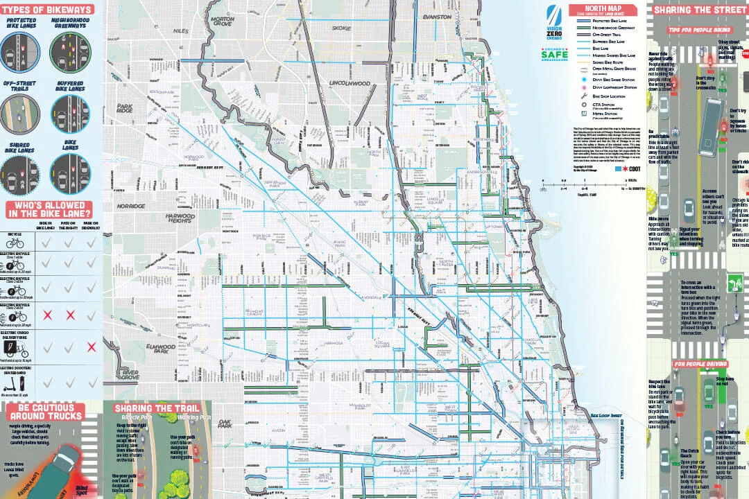
For the best insight into the 77 neighborhoods of Chicago, including what festivals, entertainment, food, and culture the Windy City has to offer, download the Chicago neighborhoods map that displays the intersections with major streets and discover hidden gems in places not always listed on tourist maps.
Visiting the city and want an overview of the most popular attractions? Look no further than the tourist map of downtown Chicago, outlining the 26 top attractions in downtown Chicago, including 360 CHICAGO Observation Deck (formerly John Hancock Observatory).
Take your Chicago sightseeing a step further and create a customized plan with this map of Chicago attractions. Select and plan your destinations according to your own personal interests and get a map to ensure that you don’t miss a single exciting experience. Download the Chicago Attractions Map to get where you want to go below.
Before departing, utilize the airport map for the four Chicago O'Hare International Airport terminals. This map covers everything from airline locations to food and shopping to provide a complete airport orientation before takeoff.
Now you are ready to explore Chicago! For more tips and things to do in Chicago, visit our blog.
Like this Article? Pin it for later!
"*" indicates required fields


 Click for Accessibility